Reactscape device:space
Land Building
Devon Boutte and Martin Moser developed the land building logics Phase 02 proposal that evolved from the original ecolibrium proposal from Phase 01.

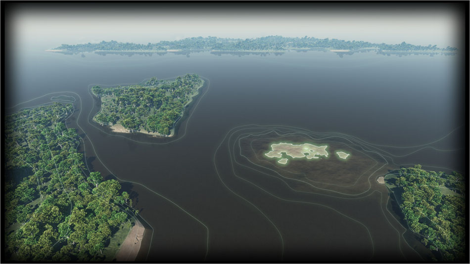
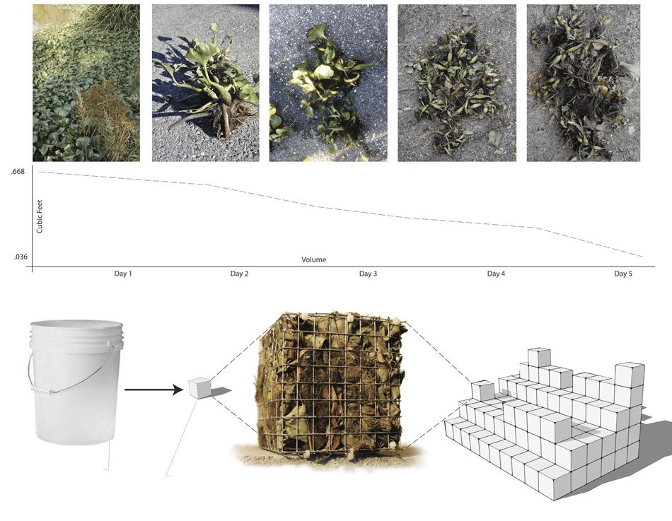
The proposal for this project expands on several discrete aspects of the City Sense project Ecolibrium. Ecolibrium proposed utilizing real time data sensing in the Atchafalaya basin to convert negative ecological problems into positive byproducts with the intention of providing more ecological resiliency, or fitness, to these negative problems as they are managed in the future. Currently, certain ecological processes, directly resulting from current or past human intervention, have detrimental effects on the basin. The ecological processes investigated within Ecolibrium are algae blooms, excessive water hyacinth populations, and sedimentation. This proposed land management project takes into account the fluctuations of these processes throughout the year in both their negative effects as well as the opportunity for positive byproducts through management, focusing specifically on algae and water hyacinth. Managing land building in the Atchafalaya Basin redefines land-building strategies, and focuses on a nuanced, calculated approach to utilize biomass generated from algae and water hyacinth as a land building substrate.

Several ecological issues arise from the excess of algae and water hyacinth growth in the Atchafalaya Basin. If this plant material benefits from the nutrients and agricultural runoff that flows into the basin and the vegetation thrives, it creates hypoxic conditions for underwater fauna. These hypoxic conditions, marked with depleted underwater oxygen levels, create massive fish kills and offset the normal ecological balance. The basin has also suffered the detrimental effects of altered hydrology, stemming from human interventions for logging and oil and gas exploitation. This altered hydrology has resulted in erosion and changes in sedimentation patterns, resulting in land loss.

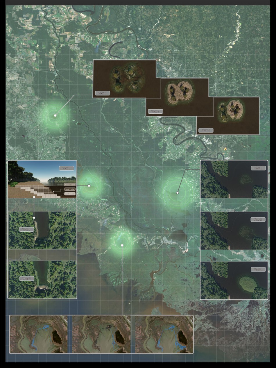
This project provides an alternative to traditional land building methodologies – the typical paradigm is permanent, cumbersome, and unable to react to change. The Army Corps of Engineers, for example, approaches land and land building as simply another infrastructural element – one to be analyzed, sited, built, and maintained when necessary – when in reality, land is part of a living, fluctuating ecological system, and must be managed as such. Utilizing real time data to drive land building locations and patterns allows a responsive environment, capable of functioning at a micro scale and reacting to macro system changes. In this project, sensors located throughout the basin provide real time fertilizer inputs and quantify where land building substrate is available throughout the basin. Additionally, by specifically locating where this biomass substrate is available and in what quantities, an average location of these points shows where land building could most efficiently occur.
The real time data sensing is investigated within this project at a number of scales and time periods. Within the Atchafalaya Basin, ecological systems fluctuate based on inputs from millions of influences. Within the scope of this project, it was necessary to understand some specific factors that relate to the growth and management of the major ecological systems.
In order to provide this real time data, sensing network of three different scales is employed to sense the large picture, zoom in, and finally sense at a micro, nuanced scale. These scales each imply a different time scale of sensing as well. By sensing this data at a variety of scales and times, a wholistic model of real time data is able to be interpolated to provide a glimpse into any given moment in the basin.
The data that this sensing model provides is dynamic and fluctuates according to normal yearly trends as well as unseasonal and unexpected events and systems. Expected year-ly trends may include the seasonal flooding of the basin in the spring of each year, due to the snow melt.
Unseasonal or unexpected events may be storms, ecological pestilence, or industrial accidents.
In addition to the macro cycles on which these different data inputs fluctuate, the sensing model is also able to sense and identify micro changes in real time. Within each of these data criteria, minor fluctuations due to daily or even hourly micro-adjustments have an affect on the macro system. The real time data sensing model is able to pick up on these changes and provides a tool with which to aide programming and design.
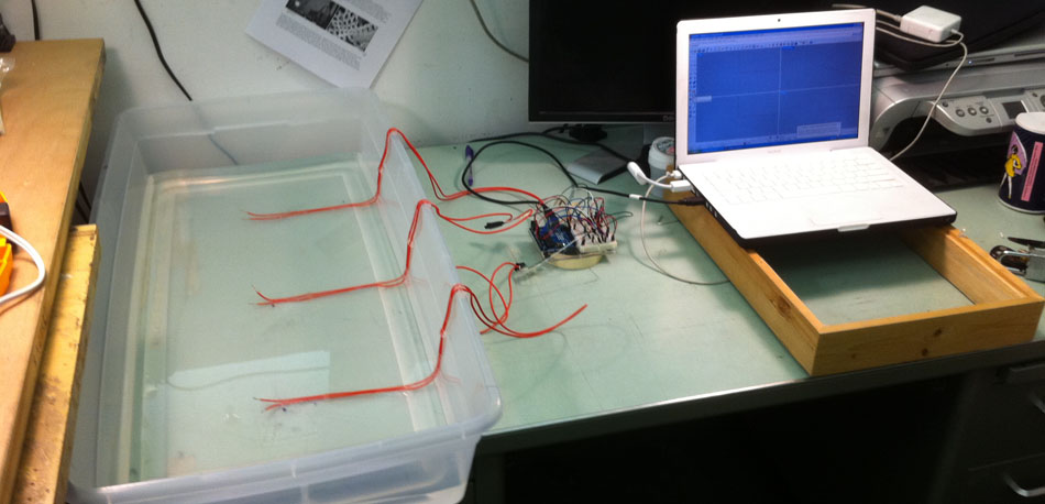
Figure #1 depicts the interface between the computer, arduino, and sensing model to help develop the typology and land building rules. This model offers an effective scale to sense the nuanced, micro scale changes and how they affect the macro systems.
In addition to the data fluctuations, the rules that govern the land building are dynamic as well. This type of calibration model requires a feedback loop of real time data sensing, land building, programming, and critique. The goals and rules of the land building strategy may be in flux until a best management solution has been reached. This hypothetically may take a number of months or years to perfect.
All of these various land building models were prototyped with a combination of arduino, grasshopper, rhinoceros, and City Engine modeling software. The arduino and grasshopper interface provided a basic environment in which to program the basic rules were investigated, and City Engine offered additional parameters with which to understand these rule relationships.
This land building will occur according to a series of typologies and rules that reflect the context of the basin near the current location of the land building point. Three land typologies in the Atchafalaya basin: edge, open water, and fragmented, have been identified and are reflected in the land building process. Additional rules within each typology guide the creation of land in reaction to more specific real time data at a site scale. The factors for determining the rules at the local scale may include more specific spacing, connecting, height, and proximity characteristics than the typological rules. The process for determining some of these rules involved utilizing scaled sensing models of the basin to provided a means of physical study of real time data inputs. Additionally, incorporating City Engine software into this investigation may provide another tool for effective parametric modeling to aid in the adaptation of land building rules. As shown in Figure #2, it was necessary to investigate an interface between the grasshopper enviornment and the City Engine environment in order to further understand the land building rules. Ultimately, all of these typologies and rules come together in a loop for ecological fitness and efficient land building, driven by the programming sequence of rules and typologies, and supplemented by feedback from the real time sensing data that updates in response to changing site conditions.
As technology continues to advance into the 21st century, humans are being provided with increasingly efficient and intelligent options to man-age increasingly complex operations and relationships. Real time data and its ability to interface with these new technological devices offer promising opportunities for ecological land management strategies in the Atchafalaya Basin. This new way of managing land building contradicts the contemporary belief that ecological infrastructure must be static and lifeless. Rather, these new pieces of ecological infrastructure offer a nuanced and dynamic footprint of land building that actively manages biological nuisances in ways that result in positive outcomes for both ecological resiliency and ultimately human use and inhabitation.
One Response to Land Building
Leave a Reply
You must be logged in to post a comment.

Pingback: Reactscape » Archive » Responsive Systems Studio Fall 2011